🌦️ Weather Bulletin: Monday, June 1st
- Jun 1
- 1 min read
General Situation:
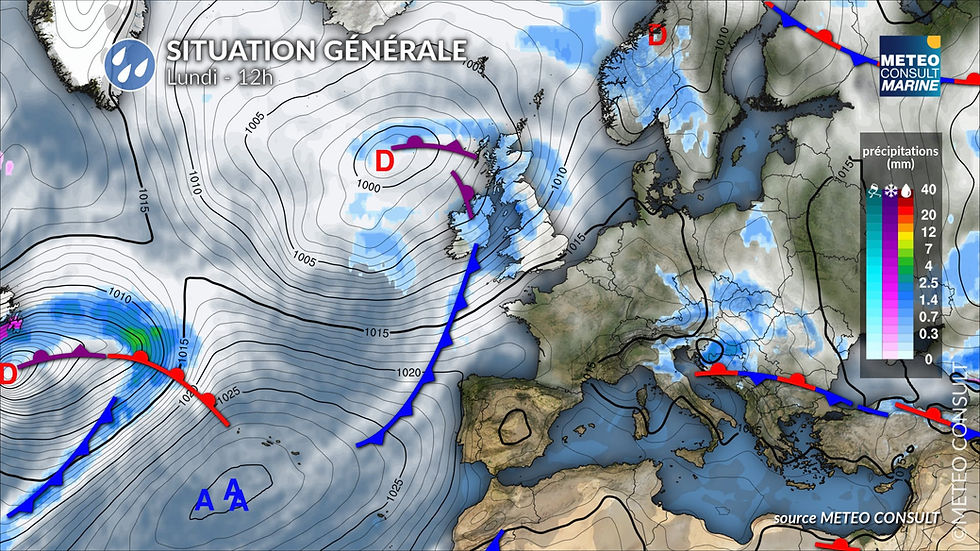
Monday , a 1019 hPa ridge will be located over the southern part of the Bay of Biscay. Moderate southwesterly winds will prevail over the northern part of the Bay of Biscay, ahead of a cold front over the near Atlantic. The cold front will pass through during the night from Monday to Tuesday.
On Tuesday , a fairly strong and unstable west-northwest flow will occur between the Azores High at 1032 hPa and a low-pressure system centered at 1000 hPa over the north of the British Isles.
Wednesday , strong southwest flow in the Channel with an active cold front located on an axis from the Isle of Wight to the Bay of Saint-Brieuc at midday.